Eocene of Egypt
Sequence stratigraphy and stratigraphic paleobiology in the Bartonian-Priabonian of Wadi al-Hitan, in collaboration with Philip Gingerich, Univ. of Michigan. Some of this work is described in Peters et al. (2009) Palaios, in Peters et al. (2010) Geology, and in Gingerich et al (2012) Geology.
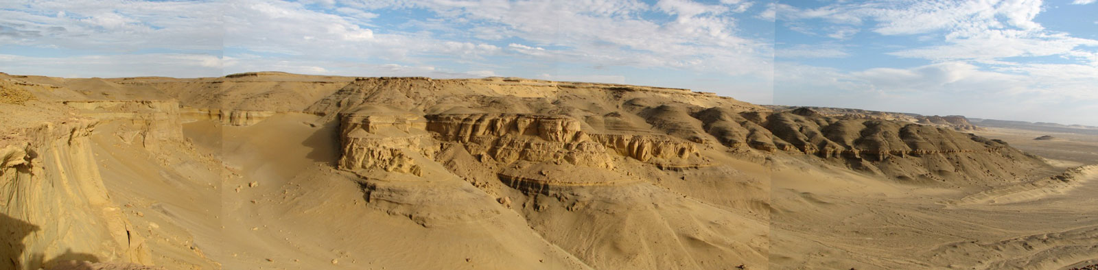
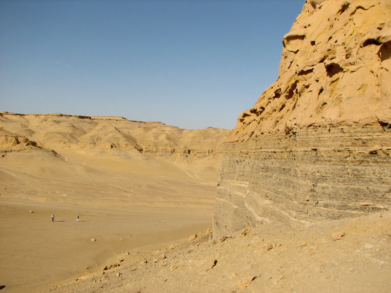
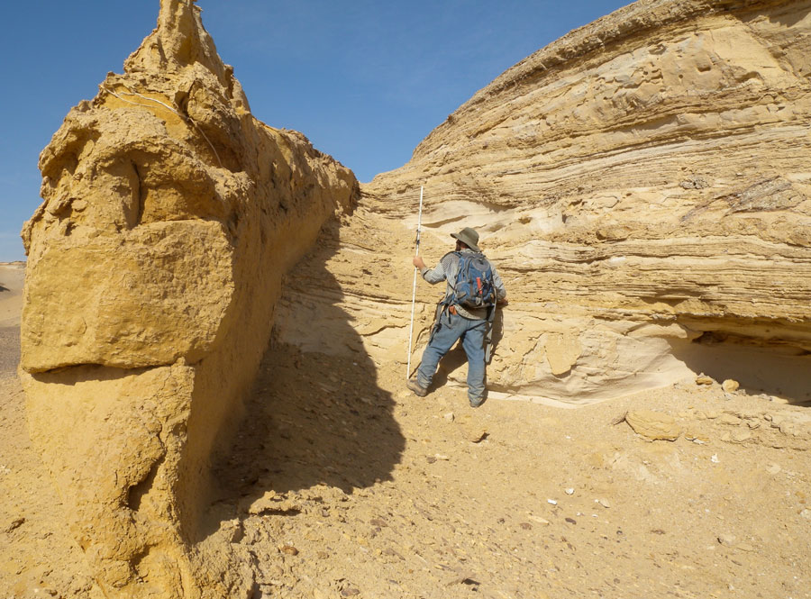
Outcrop. 100% exposure of siliciclastic shelf deposits.
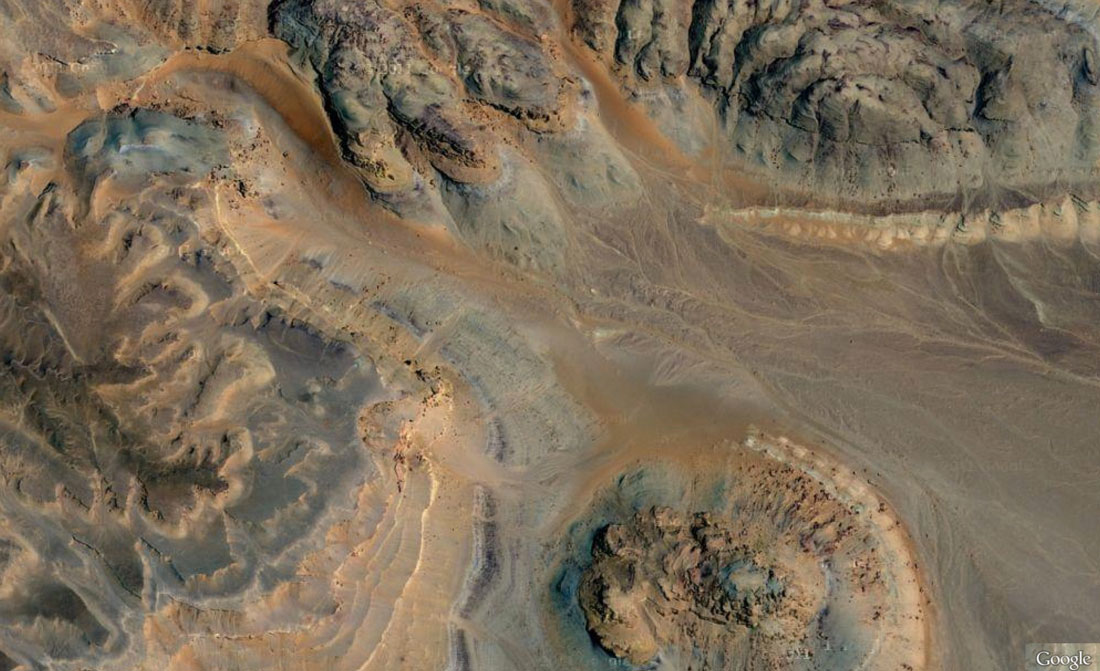
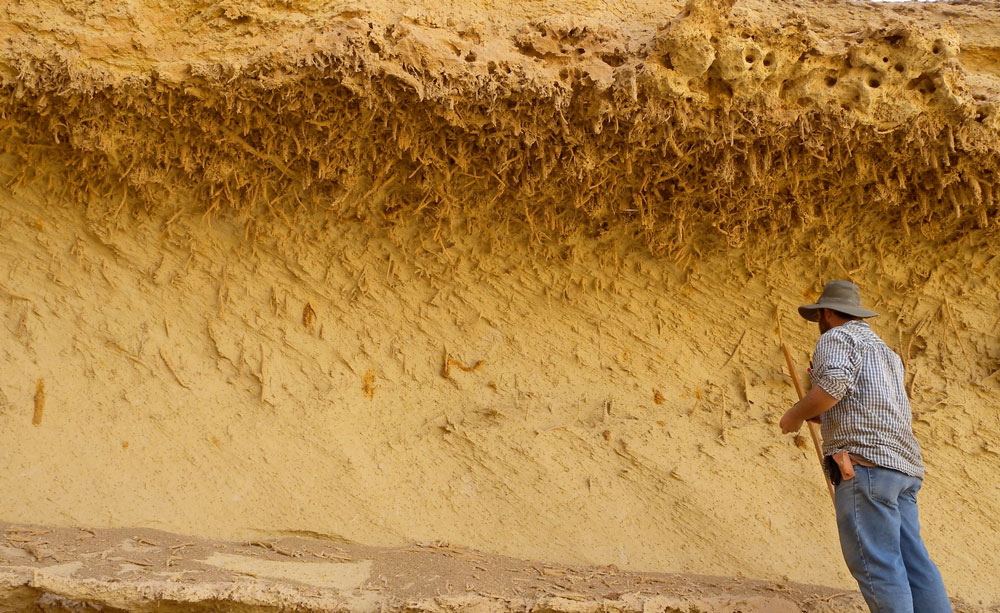
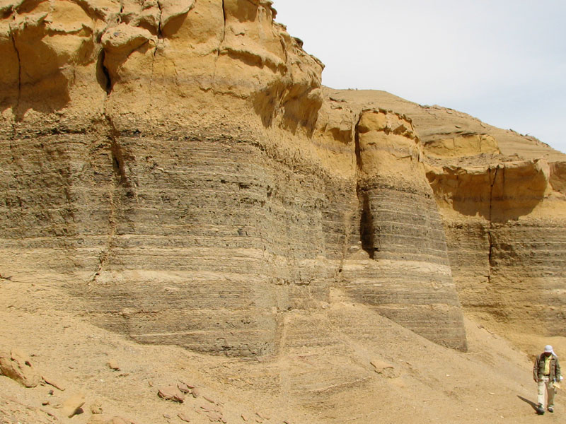
There is virtually no vegetation of any kind in Wadi al-Hitan, and the dominant mechanism of erosion is via windblown sand. The resulting exposure is spectacular and unique. Stratigraphic surfaces can be traced continuously in outcrops in an onshore-offshore direction. This photograph was taken looking NNW from near the top of the rounded butte in the Google satellite image above.
Paleobiology. Whales with legs.
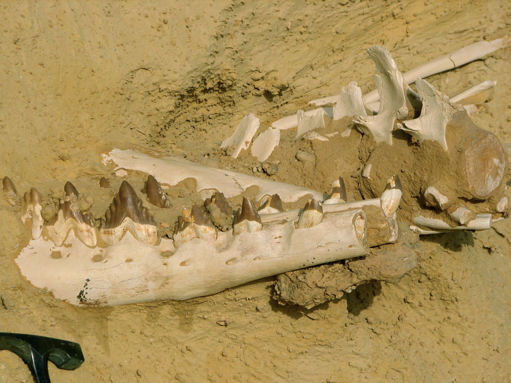
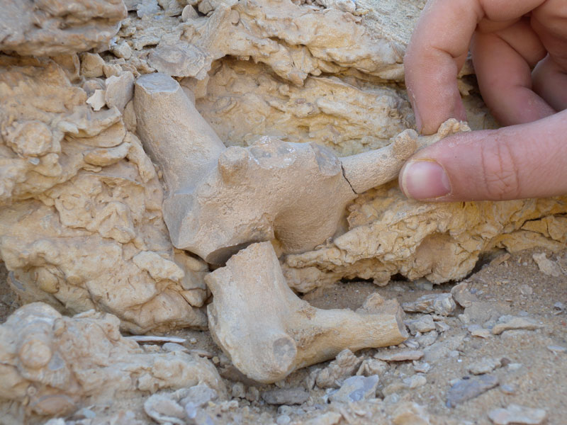
Wadi al-Hitan is a World Heritage Site and is strictly protected, but still open to scientific investigation. The main draw for paleontologists are the abundant marine vertebrate fossils, including Dorudon (pictured here) and Basiliosaurus. For more information on the marine mammals from Wadi al-Hitan and an overview of the litho stratigraphy see Gingerich 1992.
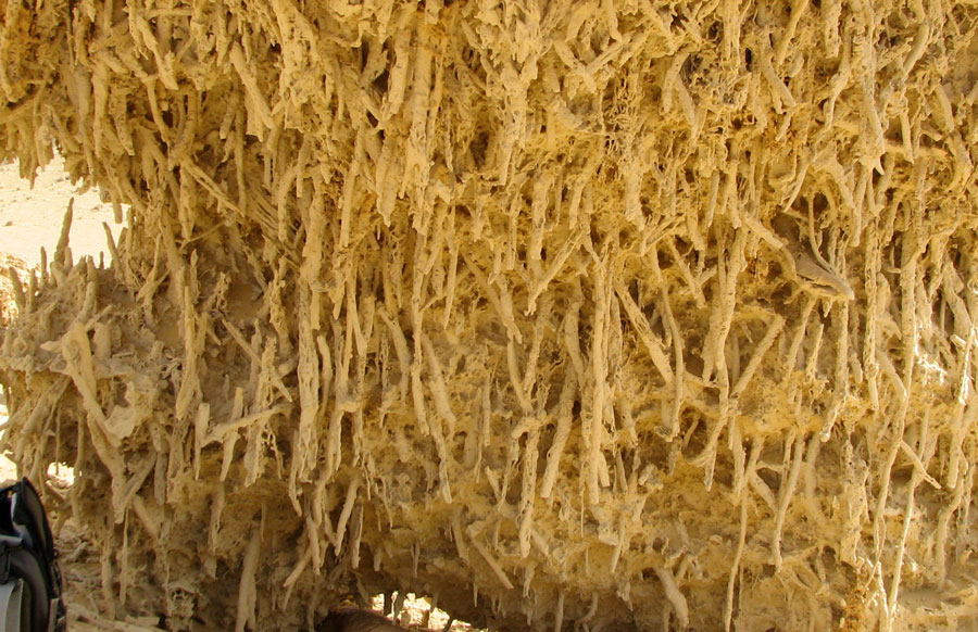
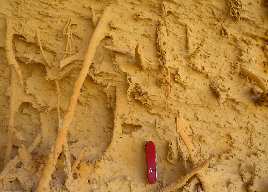
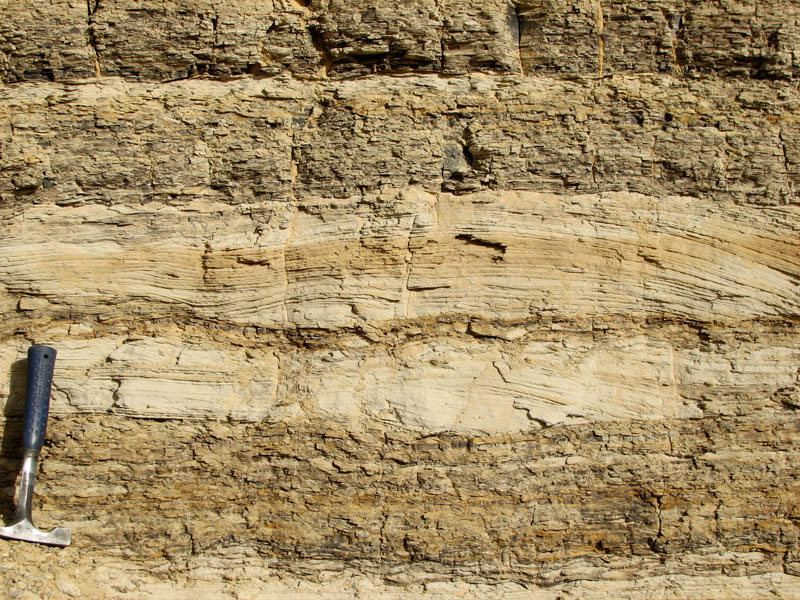
Wind sculpted. Ichnofabrics in a whole new light.
Many of the shelf siliciclastic sediments at Wadi al-Hitan are homogenized by burrowing, but in normal outcrops individual burrows can be hard to discern. Wind erosion of some outcrops, however, excavates clay-lined burrows in exquisite detail, providing three dimensional expressions of bioturbation that otherwise would be very difficult to discern. Most flooding surfaces are well-defined by burrows.
Sequence stratigraphy. Sequence boundary.
The primary sequence boundary in Wadi al-Hitan occurs at the base of an incised valley and is characterized by laterally discontinuous conglomerates (iron-cemented sand clasts) with disarticulated and abraded terrestrial and marine vertebrate bones and teeth. Here, Eric Williams stands next to a portion of the sequence boundary that is vertically expressed. It formed as a localized erosional cut-bank (to left of Eric) filled by incised valley fill.
Sequence stratigraphy. Incised valley fill.
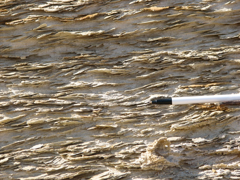
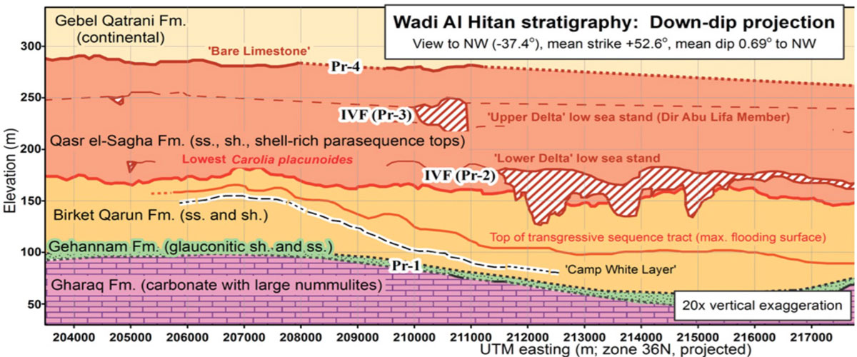
One of the most distinguising characteristics of the Wadi al-Hitan stratigraphy is a discontinuous body of rhythmically bedded very fine sand and mud with complex internal stratification. Erosion surfaces, mud-sand couplets, and inclined heterolithic stratification are pervasive. Bioturbation is essentially absent, plant fossils abundant, and current indicators (ripple-scale cross laminations) unidirectional. This tidally influenced estuary deposit represents an incised valley fill (IVF) formed following Pr-2 sequence boundary fluvial incision. The cross section below, made by physically tracing stratigraphic surfaces with GPS and then projecting into a plane, shows the geometry of the IVF (from Gingerich et al. 2012).
Sequence stratigraphy. Transgressive surface of erosion.
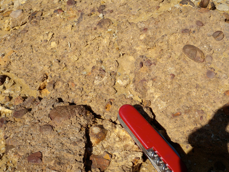
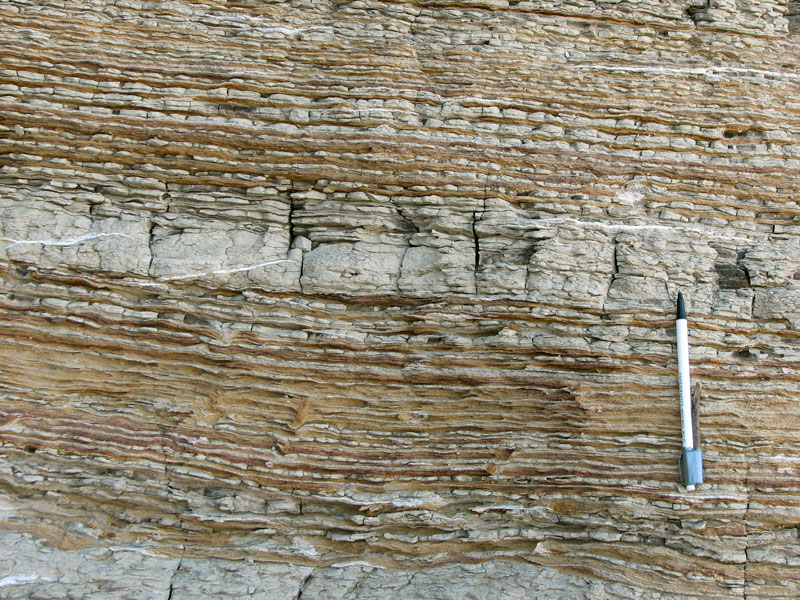
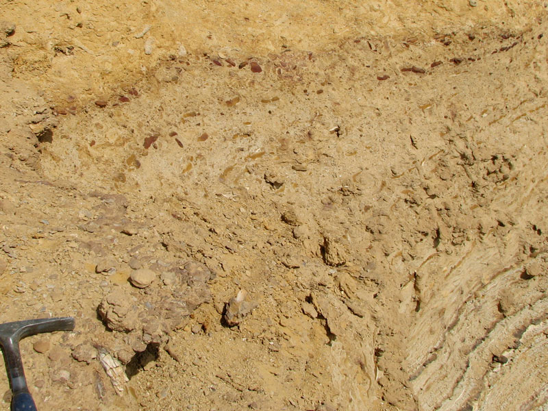
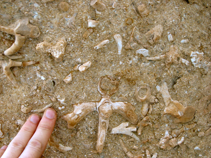
The IVF is sharply overlain by a marine ravinement surface that has prominant Thalassinoides penetrating into underlying IVF and a well-developed lag consisting of shells, sea cow remains, shark teeth, and iron-cemented sandstone pebbles and cobbles. Truncation of IVF inclined heterolithic strata is visible in the photograph above. On the interfluves, the transgressive surface is prominent but juxtaposes marine shelf deposits, making the surface a combined sequence boundary and transgressive surface.
The transgressive surface of erosion (ravinement surface) is also characterized by rip-up clasts of underlying fine-grained marine mudstone and well-cemented cobbles that preserve the coarsest sand observed in the entire section. These cobbles, often encrusted by oysters, likely derive from sedimentary deposits that were destroyed during transgression. The TSE also marks the appearance of fully normal marine inverebrates like corals
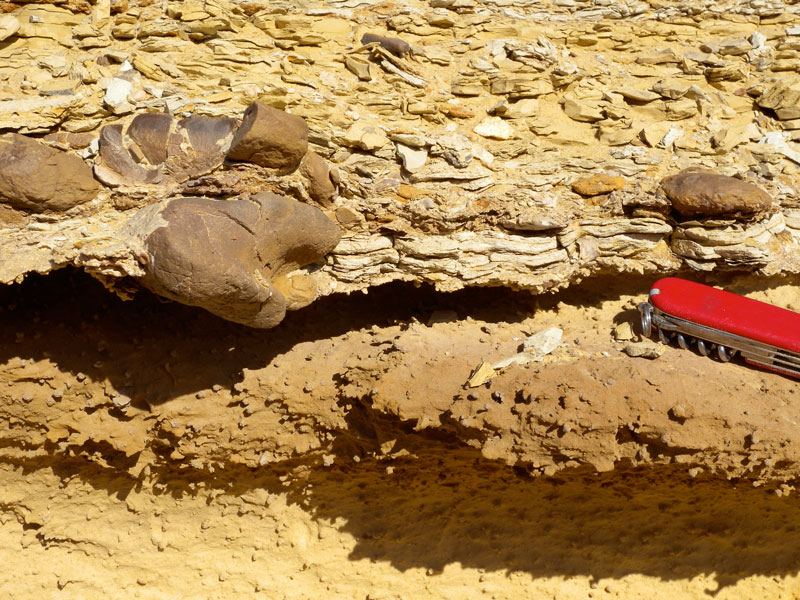
Bizzare TSE occurrence. Kerunia.
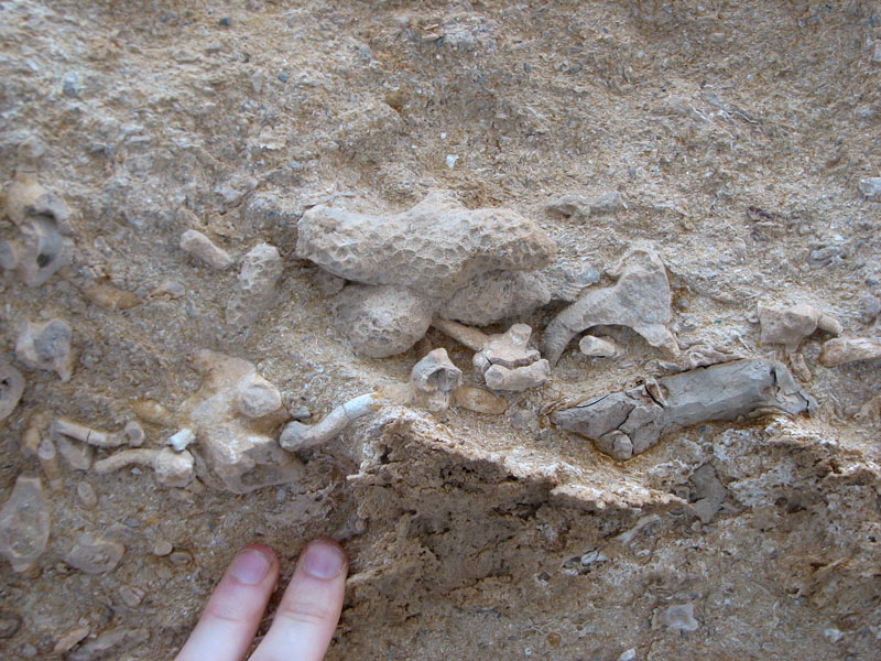
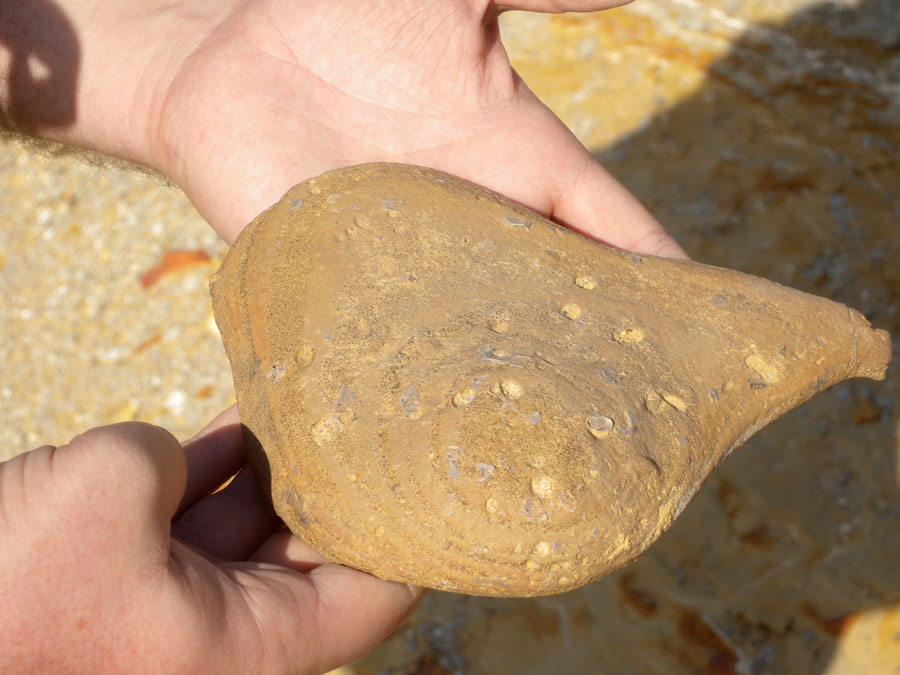
Occurring abundantly on the transgressive surface of erosion and the associated 10-50 cm thick invertebrate skeletal lag deposit, and exclusively on similar flooding surfaces in the early transgressive systems tract is unusual calcareous fossil called Kerunia. These interesting robust forms are very diverse in morphology, but commonly have an aperature-like opening and a branching bilateral symmetry not unlike deer antlers. This led Dolf Seilacher to suggest that Kerunia was commensal on snails or hermit crabs, the symmetry providing balance. In actuality the form of Kerunia is highly diverse and can culuminate in massive calcreous mounds. The occurrence of Kerunia exclusively on flooding surfaces and associated, coral-containing skeletal lags of the early TST suggests a strongly environmentally sensitive taxon, perhaps a hydrozoan.
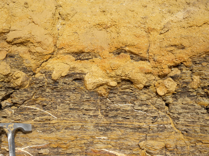
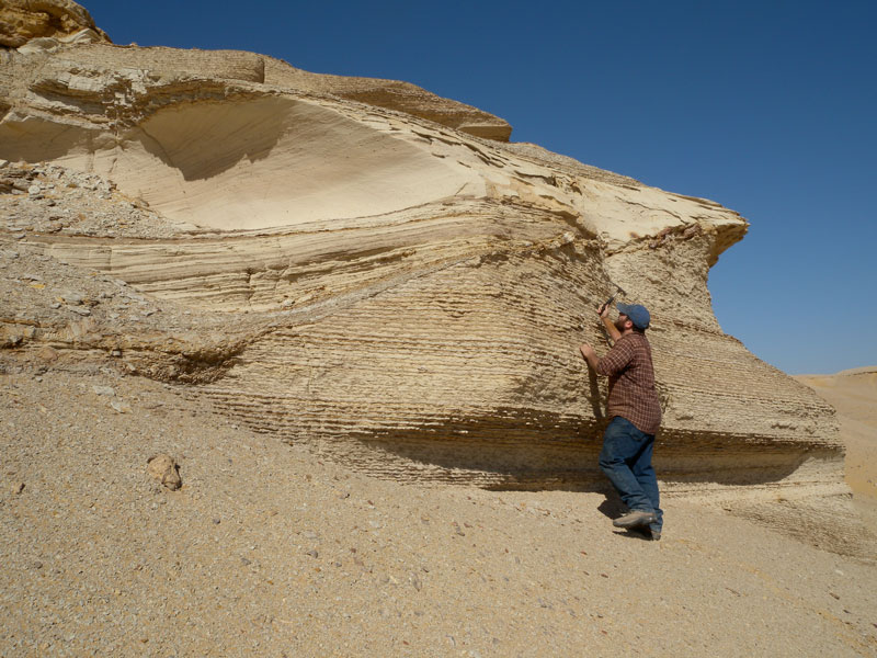
Sequence Stratigraphy. Regressive surface of marine erosion.
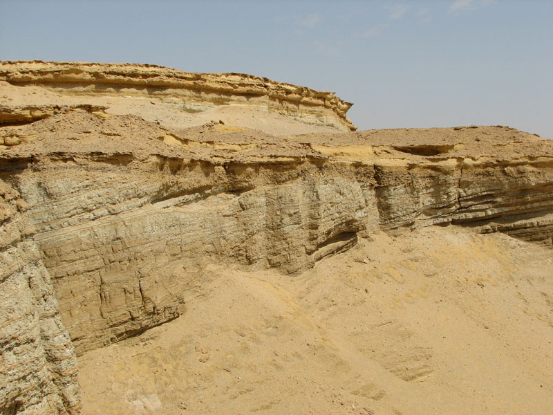
A prominent regressive surface of erosion marks the base of a locally thick falling stage systems tract, but only near the base of the clinoform traced in the cross section above (the maximum flooding surface is labeled in the diagram and the upward slope to the left traces the clinoform). The surface is characterized by a sharp silty mud-sand contat with well developed Thalassinoides piping sand down into the underlying offshore muds (which contain interbedded hummocky cross-stratified sands (below). In many places the FSST is absent, due both to non-deposition and or erosion in up-dip directions and due to complete fluvial excision during the subsequent lowstand. In the photograph above, the IVF is visible near the top right, unconformably overlying the FSST sands. In the overview photo below, the regressive surface of erosion is prominent in the foreground and can be traced across valley. The IVF, capped by the TSE, is visible above the FSST sands.